Contested spectrum
Missions fail in unknown RF environments. Forces operate without a picture of jamming, spoofing and hostile emitters around them.
AI-powered RF intelligence for defense, intelligence and national-security organizations. A measured picture of every network in your area of interest, threats that stand out against a real baseline, and positioning that holds when GPS does not. Software only: no hardware, no network access, no exposure.
Sovereign, air-gapped deployments in service · Multi-year renewals by defense and intelligence organizations
Cell geolocation with sector footprint
Positioning without GPS
Mapping resolution
Real-world RF measurements
Passive, zero exposure
The spectrum decides whether communications, positioning and situational awareness hold. Most forces cannot see it.
Missions fail in unknown RF environments. Forces operate without a picture of jamming, spoofing and hostile emitters around them.
GNSS jamming and spoofing deny positioning and navigation exactly when the mission depends on them.
Open cell databases are tower-level guesses, stale by months. Drive tests cover a road, not a coverage footprint.
Five operational questions, one measured RF picture. Choose the one closest to yours.
Real-world RF measurements fused into a continuously refreshed picture of every network, from a single city to a whole country.
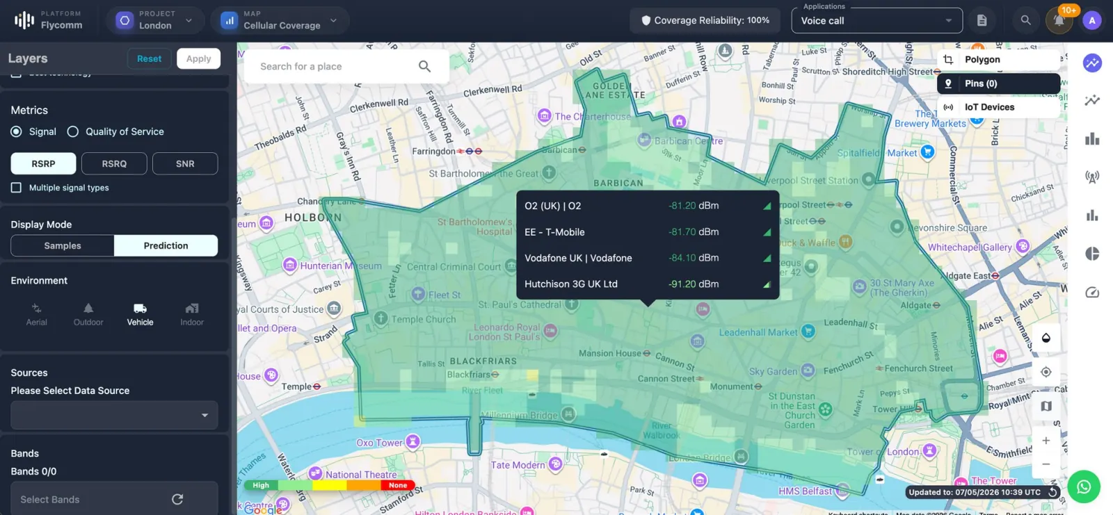
Every network in your area of interest, built from real-world measurements at 10 m resolution. Cells located to ±60 m with sector, band and technology.
Indicators are scored against a real baseline, so rogue cells, spoofing and jamming actually stand out instead of drowning in noise.
Positioning from the radio environment to better than 100 m when GPS is jammed, spoofed or simply unavailable.
Fully passive. No hardware, no access to any network core, no third-party data and nothing that transmits.
One picture of every network in the area, and of what does not belong.
Illustrative views here; the operational detail is for your briefing.
Operators, cells, bands and technologies actually serving a location, measured on identical data, before anyone deploys.
Cloud, on-premises or fully air-gapped. No hardware to deploy, no access to any network core and nothing that transmits. Live in days, not programs.
The field interface for authorized government and public-safety operations, built on the same measured RF picture.
Annual licences scaled by coverage cluster, from a single city to national, or by API query volume. Paid pilot programmes are fully credited toward a licence. Cloud, on-premises or fully air-gapped sovereign deployment, with training, integration and dedicated engineering available.
Scope a paid pilotNo. Flycomm is software only: nothing to install in a network, no core access and nothing that transmits. Intelligence is delivered through the platform, APIs or data packages.
Yes. Cloud, your own cloud tenancy, on-premises or fully air-gapped. Sovereign deployments are in service today.
Through REST APIs and versioned GeoJSON data with a documented schema, so the intelligence lands inside your own GIS, analysis and command tools.
A scoped pilot on one area of interest typically starts within weeks and is credited in full toward a licence.
Flycomm works with authorized defense, intelligence, national-security and public-safety organizations, under the applicable legal frameworks and export rules.
Bring one area of interest. We’ll build a focused capability briefing around it.
Request a capability briefingTell us what matters to your team. We’ll show you how Flycomm can turn wireless intelligence into your next advantage.
sales@flycomm.co